The Atlas of Mysterious Places of the Ancient World
- Publisher Bompiani
The “Atlas of Mysterious Places of the Ancient World” is the second volume in the series dedicated to mysteries after the first book “Atlas of the Mysterious Places of Italy”. Collected in this new work are illustrations depicting the most fascinating mystery stories of ancient times from all continents.
This atlas returns the unrepeatable excitement of discovery and the irrepressible joy of a bet won almost always against all common sense.
The illustrations in the volume are full-page plates and depict the mirages and legends that are seemingly insubstantial but often end up awakening the answer to those questions that each of us carries within ourselves.
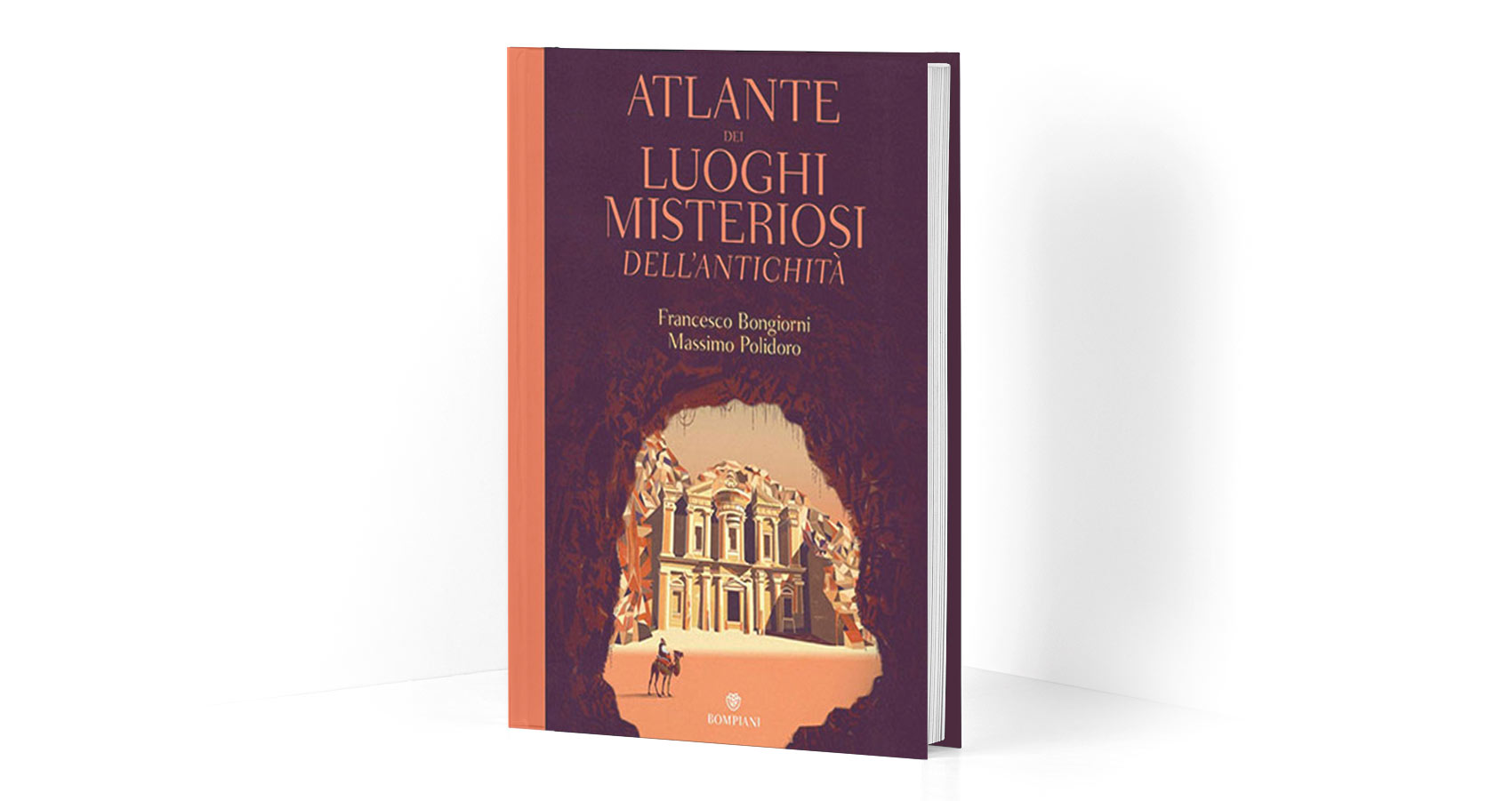
Illustrated book Cover of the “Atlas of Mysterious Places of the Ancient World” published by Bompiani (Italy).
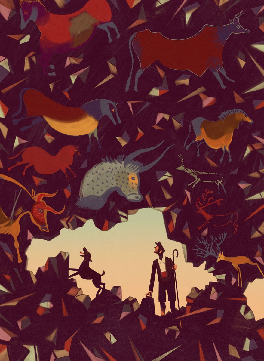
Illustration of The Lascaux Caves. This artwork depicts the cave complex located in southwestern France near the village of Montignac.
The cave complex was accidentally discovered on September 12, 1940 by four French boys and contains examples of wall art dating to the Upper Paleolithic. Many of these Art works are dated to an estimated date of 17500 years ago.
The most commonly depicted theme is of large animals of the period, including the aurochs, now extinct, rendered with great richness of detail.
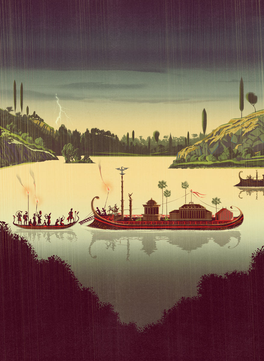
Illustration of the Nemi Ships: two Roman imperial ships attributable to Emperor Caligula that sank to the bottom of Lake Nemi. The legend of the existence of two large ships submerged at the bottom of the lake was passed down by locals for centuries until the two ships were located and recovered in the 1930s. This artwork depicts a celebration on one of the ships.
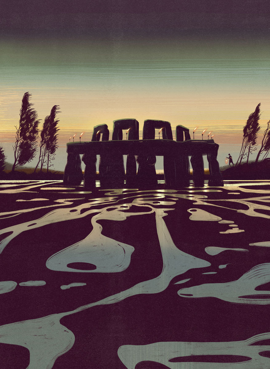
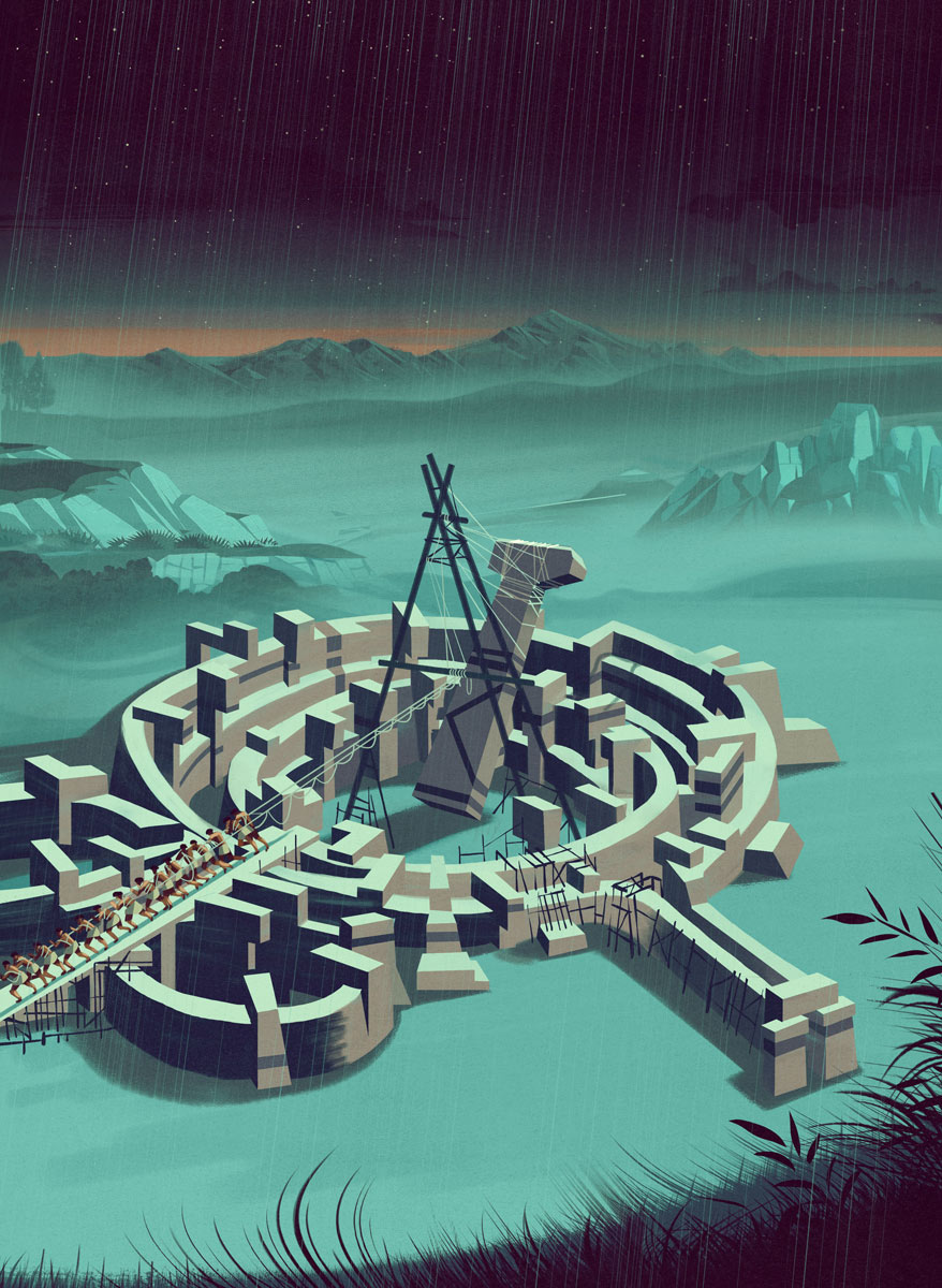
Illustration representing Stonehenge and its mysteries.
The artwork depicts the megalithic cromlech monument built in the late Neolithic period near Amesbury, in the county of Wiltshire, England,
The purpose for which this great monument was built is unknown, but it is assumed that it was used as an astronomical observatory to predict the seasons.

This illustration shows the Sacred Cenote: a voragine and a circular depression filled with water, 60 m in diameter, with vertical walls that measure 15 m from the level of access to the water surface. The illustration shows the moment in which a Maya priest performs a human sacrifice, as a tribute to their gods.
This illustration represents Göbekli Tepee: an ancient sanctuary that stands at the top of an extensive mountain range located about 15 kilometers northeast of the city of Sanliurfa in Turkey, near the Syrian border. This artwork depicts the moment when some of the buildings of what is in effect the one of the oldest places of religious worship in the world, are erected.
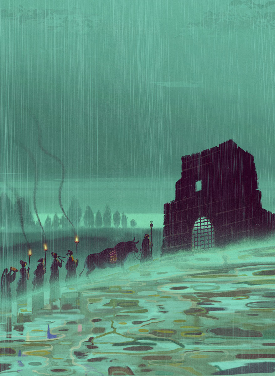
Illustration on the mysteries of Pluto’s gates. The ancient historian Strabo described the gate as follows:
Any animal that passes inside meets instant death. I threw in sparrows and they immediately breathed their last and fell. The illustration, through its colors and atmosphere, depicts the moments, charged with tension, that precede the sacrifice.
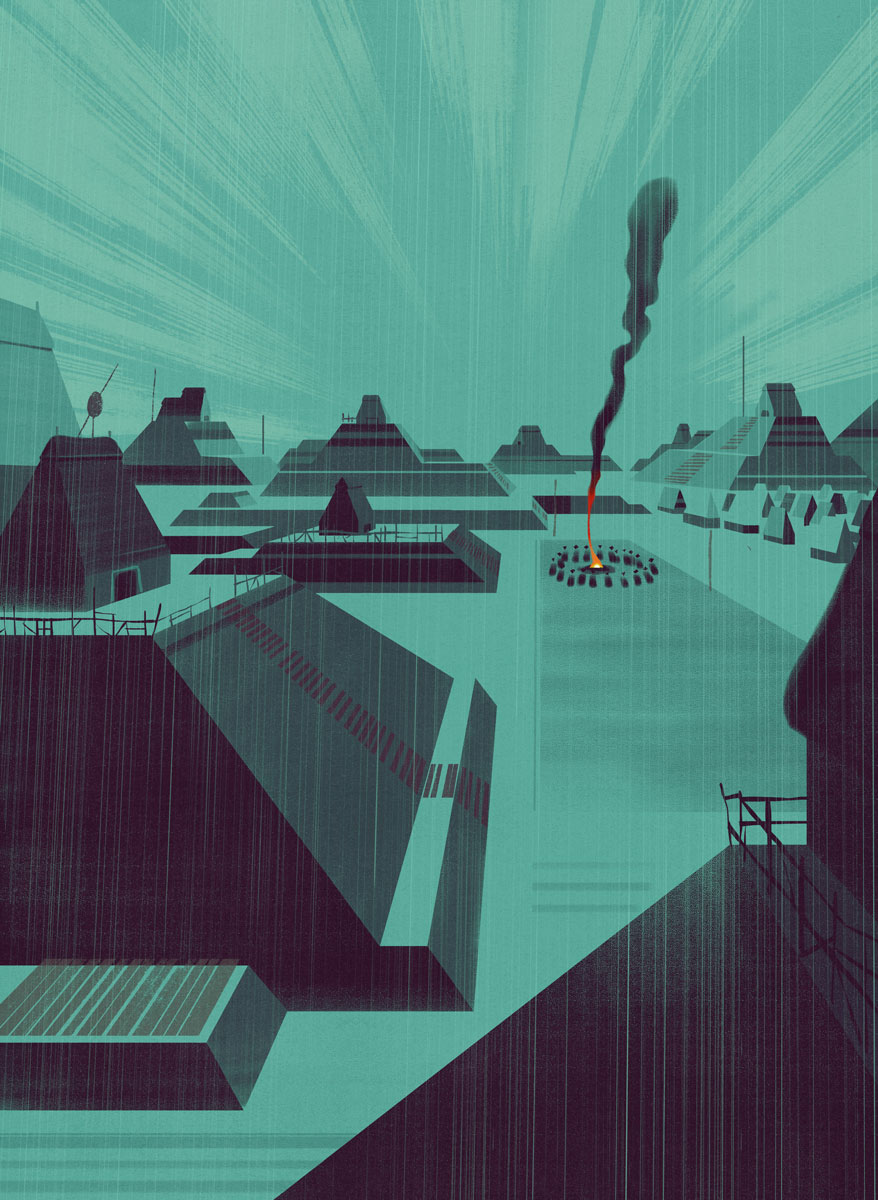
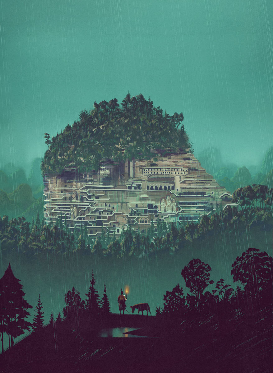
This illustration depicts Cahokia: an American Indian archaeological site located near Collinsville, Illinois. It consists of a series of artificial mounds or mounds of earth.
Cahokia is the largest site related to the Mississippian culture, which developed an advanced society in eastern North America before the arrival of Europeans.
It is estimated to have been founded four centuries before the arrival of Christopher Columbus in America. The illustration evokes the silent atmosphere of a rainy night, enlivened only by a celebratory bonfire.
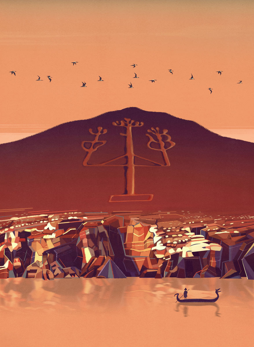
This illustration depicts the Candelabro de Paracas: a famous geoglyph, located on the north coast of the Paracas peninsula, in Peru. The Candelabro is 180 meters long and is estimated to be 2500 years old. Its meaning remains a mystery.
This artwork shows us the suspended moment when a fisherman turns his gaze to the Candelabro de Paracas before he starts rowing again.
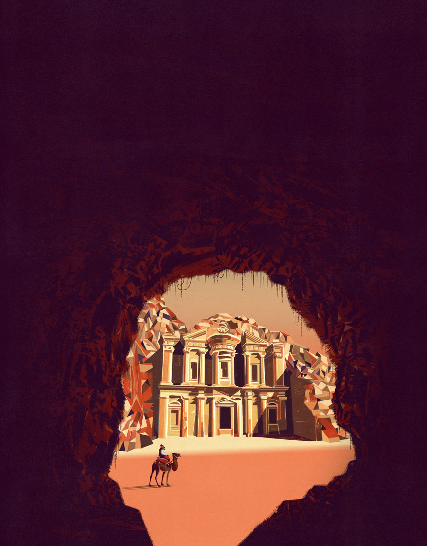
Illustration of Petra (book cover) depicting the moment Johann Ludwig Burckhardt arrives in front of “Al Deir” one of the best known and largest buildings in the ancient rock-cut city. The illustration was chosen by Bompiani as the cover for the illustrated atlas because of its evocative impact and vibrant colors.
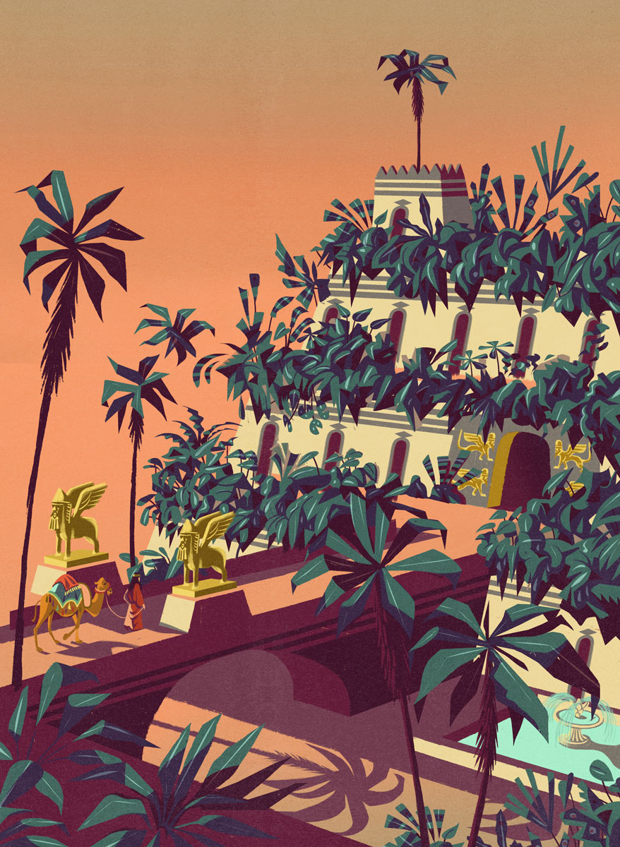
Illustration depicting the arrival of a caravan at the Hanging Gardens of Babylon-one of the seven wonders of the ancient world.
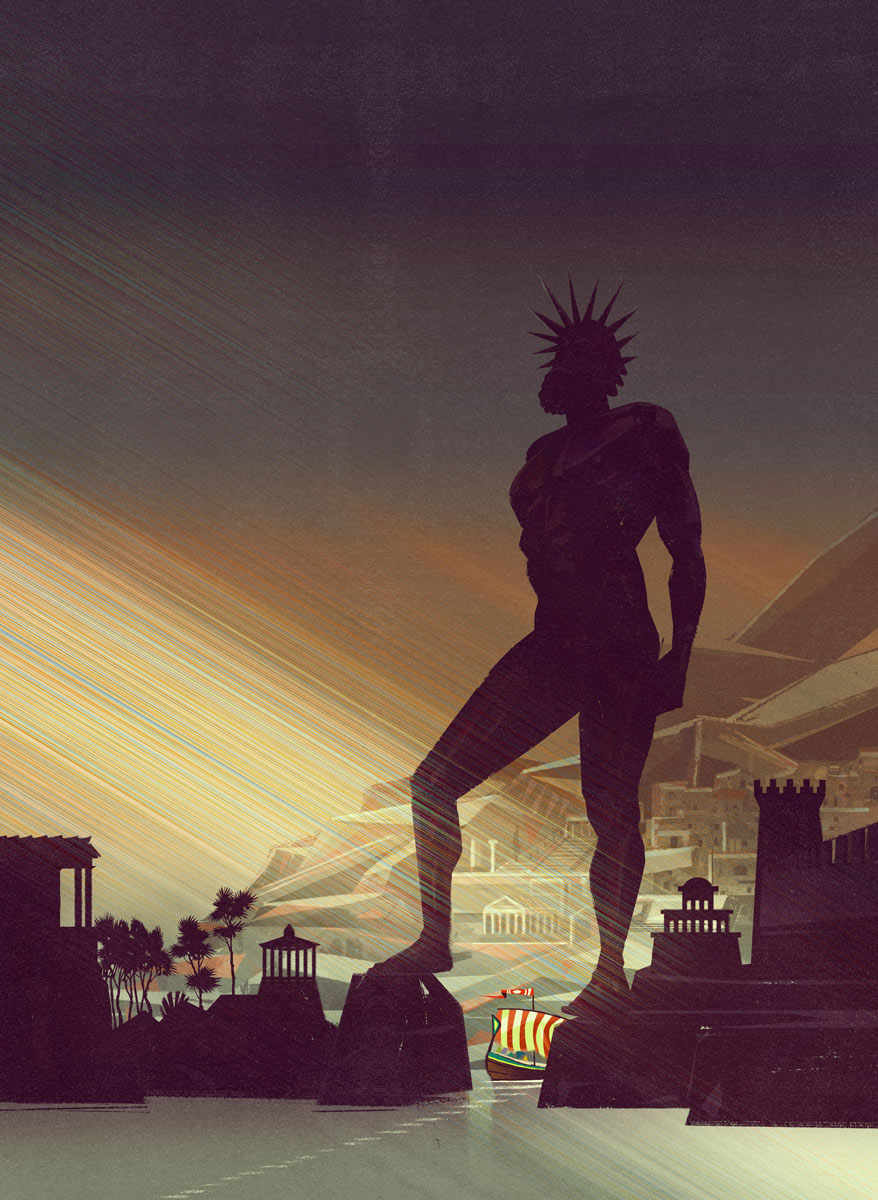
Illustration depicting The Colossus of Rhodes. This huge bronze statue of the sun god Helios was probably located in the port of Rhodes in Greece in the 3rd century B.C. It is one of the so-called seven wonders of the ancient world. The artwork crystallizes the moment when a ship is about to sail past the imposing harbor entrance with an epic atmosphere given by the contrasting colors and blinding light.

Illustration depicting a diver’s discovery of The Antikythera mechanism. It is an Ancient Greek hand-powered orrery, described as the oldest example of an analogue computer and used to predict astronomical positions and eclipses decades in advance.

Illustration depicting the toppling of the Moai. The halo of mystery surrounding Easter Island is in fact not only about the Moai, the large stone faces, and their construction by a lost people in the middle of the ocean, but also about the fate of the people themselves. What are the reasons that led them to topple the statues they had so painstakingly erected?
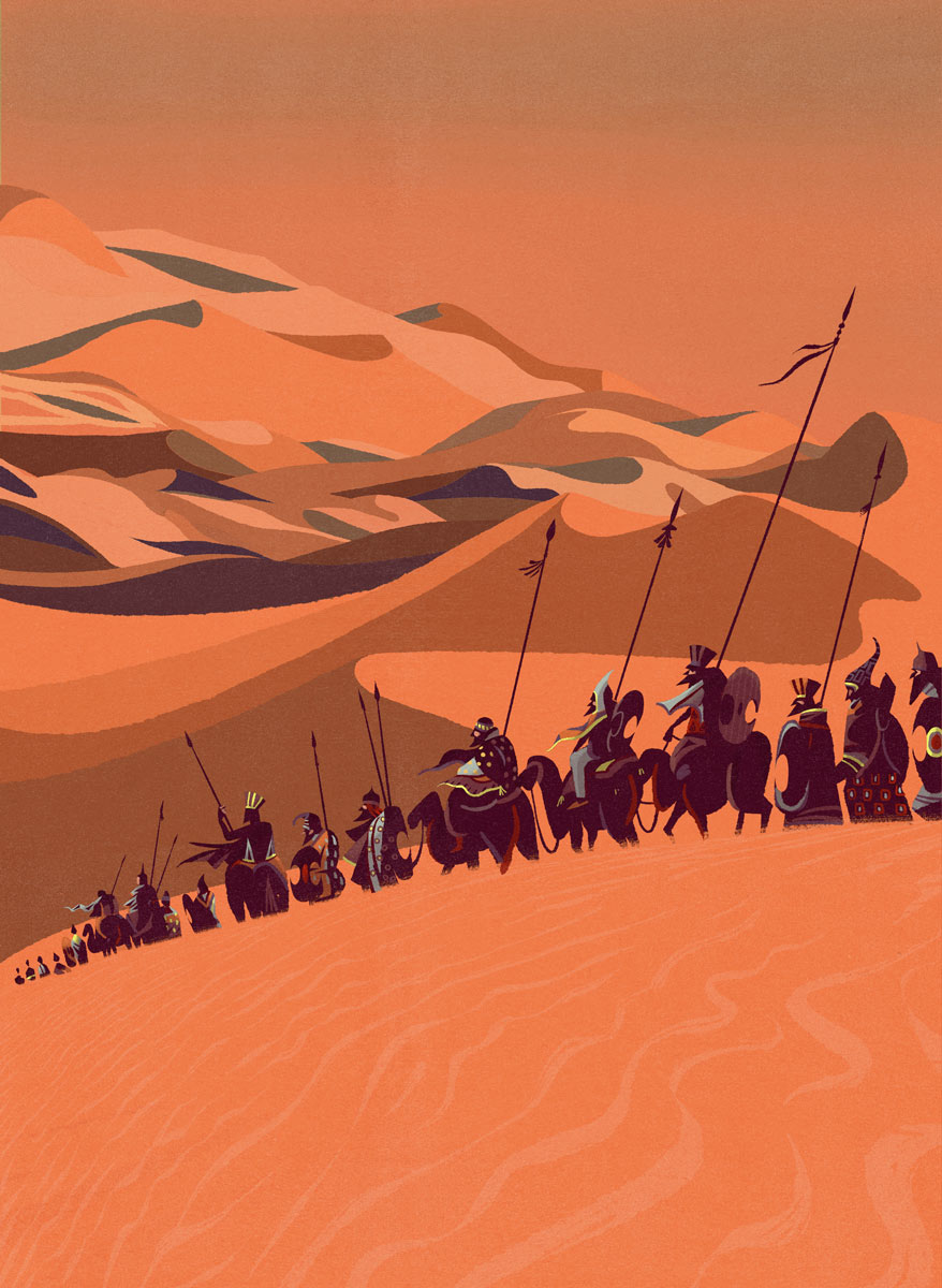
Illustration depicts the so-called Lost Army of Cambises as it enters the desert. This artwork represents the vanguard of the legendary army of 50,000 men who supposedly disappeared in a sandstorm in the Western Desert in 524 BC.
This Illustration depicts the impactful view of The Maijishan Grottoes: a series of 194 caves cut in the side of the hill of Majishan in Tianshui, northwest China.
The drawing consists of two planes and creates, through moody colors, a cold and imposing atmosphere
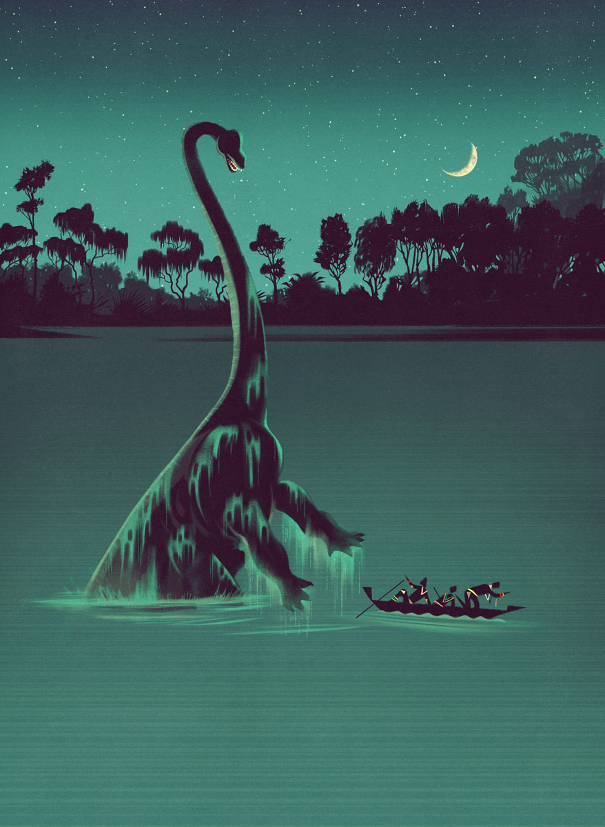
The illustration shows the unexpected chance encounter between a canoe and Mokèle-mbèmbé.
The artwork depicts the beast (Mokèle-mbèmbé is a giant animal in the mythology of several Central African cultures) immersed in the waters of the the swamps of the Likouala-aux-Herbes river in the Republic of Congo.
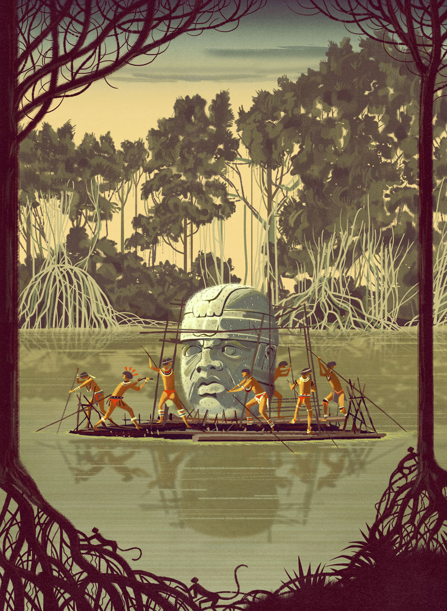
The illustration represents the carriage of an Olmec head
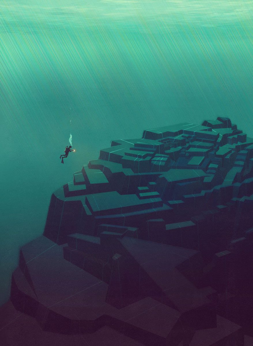
The illustration represents The Yonaguni Monument also known as “Yonaguni Submarine Ruins”: a submerged rock formation off the coast of Yonaguni, the southernmost of the Ryukyu Islands, in Japan.